


Tests and results
Testing
Anybody who desires to test the application, reporting the results, is of course warmly welcome!
Typical usage - Test procedure
- Prepare your flight plan as described previously: a flight that you know where you can recognize if the program is wrong
- You can check your GPX flight plans with Google Earth, just to see if you're not going to "fly inside mountains"
- Upload your GPX flight plan in the Routes folder of AirNavigator on the TomTom navigator
- Start AirNavigator
- In the main menu choose "Load flight plan"
- Then you can select the desired route (between the GPX files in the "Routes" folder), and choose "LOAD"
- The program will go back to the main menu, this is the moment to prepare for take off
- When ready to go press "Start Track Recorder" to start recording your effective track...
- ... and then press "Start navigation": AirNavigator will display the HSI screen
- The program will display "Wait to get a fix" or "Nav to ..." depending if the GPS unit got already a fix
- During the the flight the HSI will give the indications to follow exactly the route
- Once arrived touch the HSI screen to go back to main menu and pressing "Reverse flight plan" you can reverse your route to the original departure location
- When ready to fly back press "Start Navigation" to show again the HSI screen working on the reversed route
- Pressing anywhere in the HSI screen it is possible to go back to the main menu
- In the main menu, pressing "EXIT", AirNavigator will be terminated, if necessary it will unload the route and stop the track recorder automatically
- Download from the Track folder of AirNavigator the GPX track of your flight, again with Google Earth you can display it for analysis purposes
Results
I planned some test flight as described before and I tried to use AirNavigator on my TomTom XL. Here the results: for every test that I made, from this page, it is possible to download a zip file containing the planned route and the recorded track. In the Google Earth screen shots the original route planned is displayed in red and the recorded track is painted in blue.
29st December 2012
A nice trip in southern Piedmont, made by three flight plans:
- First from Vische airfield to Boglietto airfield
- Then from Boglietto airfield to Pianfei airfield
- And finally back from Pianfei airfield to Vische airfield
Here inside the ZIP file the three flight plans with the relative recorded tracks:
3rd January 2012
Just another short test.
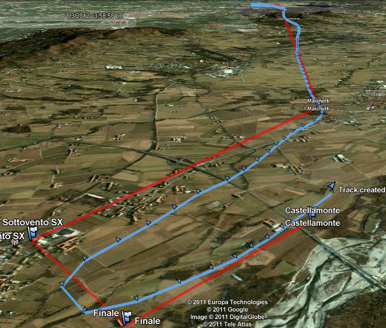
And here, in the zip file, the original planned route and the recorded track:
21st December 2011
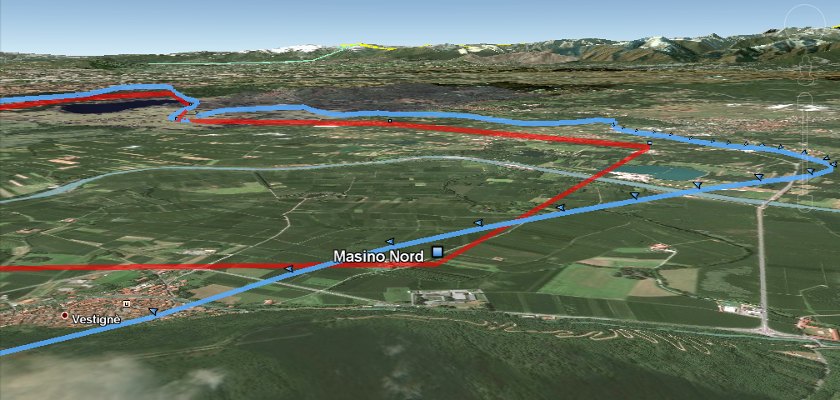
I flew a longer route to test if the application was able to bring me to an airfield where I was never been before. The flight was from the airfield of Vische to the one of Castelnuovo Don Bosco, and the program worked correctly.
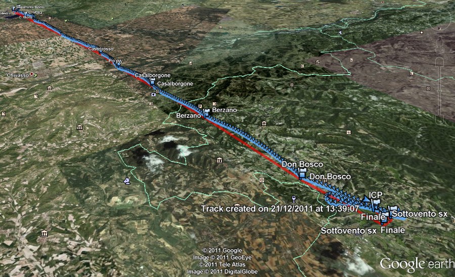
In red the original route planned, in blue the recorded track.
Here the original planned route and the recorded tracks:
19th December 2011
I personally flew the example route included in the distribution zip file. The HSI gave correct and precise indications. Here you can download the route and the recorded track by AirNavigator:
Some screen shots from Google Earth displaying the test route and track:
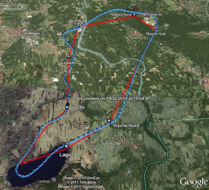
In red the original route planned, in blue the recorded track.
< Configuration | Development >