


Downloads
Disclaimer
This is a free software but it comes without any warranty: this is an experimental project, actually the main purpose is just to understand if it works and to test it. During a flight this program must not be used as the only navigation system. And also if you have the latest Garmin navigator you should be able anyway to navigate in the traditional way with chart and compass.
Assumptions
We expect that the user planned the flight before, on the ground, studying the chart and producing a flight plan as GPX file that will be loaded on the navigator.
Requirements
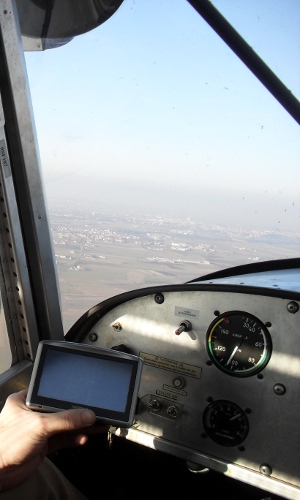
To use this software you need and old TomTom device with a screen resolution of 480x272 pixel. At the moment the program is developed specifically for that resolution. The program has been tested only on the TomTom One XL. If ran with a different screen resolution the program may display the data in a not readable way. This is the list of all the TomTom devices with a 480x272 resolution:
- Series GO: 510, 520, 530, 540, 550
- GO 630
- Series GO: 710, 720, 730, 740, 750
- Series GO: 910, 920, 930, 940, 950
- Series One: XL, XL S, XL HDT
- XL
On all the devices listed above the program should work. Anyway I repeat: I tested it only on the "One XL" model and I still had any notice about the program working correctly or not on different models.
Anyway, soon, I'm going to adapt the program to work also with the resolution of 320x240 used by the others TomTom devices. In this way the HSI will work almost all TomTom navigators, including the basic models like the "One" or the well known "GO 300".
Which distribution?
It is possible to install this software in two ways: standalone or not.
The AirNavigator executable is exactly the same in both cases; the difference is that in the standalone distribution the software is capable to run completely independently
by the TomTom software using his own operating system.
Otherwise with the normal distribution, after the installation you will have a new icon in the menu, to start the program, so in this way you can continue to use your TomTom
also for his original purpose, without the need to swap 2 different memory cards.
Unfortunately not all the TomTom software versions allow to run another program easily with an icon in the menu (the icon will not appear in the menu), in this case I
suggest to use AirNavigator as standalone on another separate SD card.
The standalone distribution is also preferred in the case where the TomTom software don't allow to access the main menu because there aren't maps installed.
Download
Here you can download the latest release of the program.
WARNING: the program has been tested only on the TomTom One XL that has a screen resolution of 480x272 pixel.
If ran on a different device with different resolution the program may display the data in a not readable way.
By downloading this program you understand that it just an experiment and must not used as the only navigation system.
- AirNavigator v0.3.1 Normal distribution for TomTom One XL
- AirNavigator v0.3.1 Standalone distribution for TomTom One XL
< Routes & tracks | Installation >